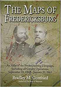
The Maps of Fredericksburg: An Atlas of the Fredericksburg Campaign, Including all Cavalry Operations, September 18, 1862 – January 22, 1863 by Bradley M. Gottfried. Savas Beatie, 2018. Cloth, ISBN: 978-1-61121-372-0. $37.50.
 Bradley Gottfried, one of the most prolific Civil War authors writing today, has devoted most of his skills in recent years to Savas Beatie’s successful Military Atlas Series. Now in its seventh installment, the series serves as an indispensable reference work for tactical-level research, battlefield stomping, and staff ride coordination alike. While the Battle of Gettysburg has been the subject of multiple outstanding atlases, including one by Gottfried and most recently an even more authoritative tome by Philip Laino, Gottfried’s mapmaking offers exhaustive, regimental-level detail for a host of other Eastern Theater clashes: First Bull Run, Antietam, Bristoe Station, Mine Run, and the Wilderness.
The Maps of Fredericksburg, Gottfried’s sixth contribution to the series, offers 124 full-color operational- and tactical-level maps tracing the course of the campaign, from the dawn of September 18 at Antietam to Ambrose Burnside’s Mud March in January 1863. As with other entries in the series, each map follows a narrative page describing events and personalities in extensive detail.
Gottfried covers the march to Fredericksburg—including a helpful map and discussion of Captain Ulric Dahlgren’s reconnaissance mission ahead of the main Army of the Potomac—before delving into the onslaught across the Rappahannock on December 11, 1862. The confusing street action that evening between William Barksdale’s Mississippians and elements of the Union Second Corps appropriately receives several maps. Visually portraying this section must have posed a challenge to Gottfried the mapmaker because Civil War units did not receive training for urban combat, forcing regiments such as the 20th Massachusetts to deploy by platoons for house-to-house, alley-to-alley fighting. His description of the action shows a solid command of the material.
Union attacks against Marye’s Heights two days later predictably garner the most detail: an impressive forty-eight maps describing the bloodshed in front of prepared Confederate defenses there. Gottfried’s narrative, replete with gripping quotations and anecdotes of desperate, disjointed assaults, complements maps, showing the systematic breakdown of one Union division after another. This level of scrutiny and dissection required a significant investment of time and research into a diverse spread of primary sources. The author did his homework. Like George Rable and Frank O’Reilly before him, Gottfried delves deeply into the Official Records, regimental histories,and manuscript sources to retrace the winter carnage along the Rappahannock. He has also mined the pertinent secondary literature, assuring that The Maps of Fredericksburg, instead of pushing fresh or revisionist interpretations, synthesizes the current literature on the campaign. The result, in visual form, is some of the most exhaustive detail readers of Civil War history are likely to receive concerning the darkest moment of the war for the hard-luck Army of the Potomac.
The Maps of Fredericksburg is a top-notch operational study that benefits from Gottfried’s judicious insights and experience as a military historian. An atlas detailing the Overland Campaign following the Wilderness is in the works. This reviewer hopes for a Chancellorsville volume to round out the actions in Spotsylvania County, the cockpit of the Civil War’s eastern theater.
Zachery A. Fry is Assistant Professor in the Department of Military History at the U.S. Army Command and General Staff College.
